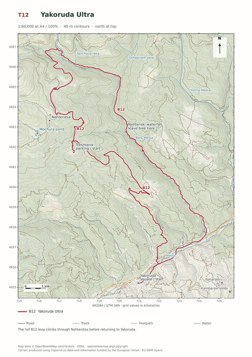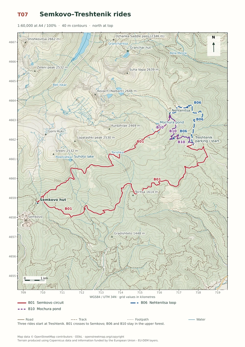
Easy · B10
Treshtenik–Mochura Pond
1–2 hours
10.9 km · ↑ 330 m · Return ride
From Treshtenik parking · transport to the start
Leisure riders comfortable climbing on asphalt and ordinary gravel.
View route and mapForest roads, sustained climbs and technical descents. Every ride lists its actual trailhead; arrange transport from Coliving.
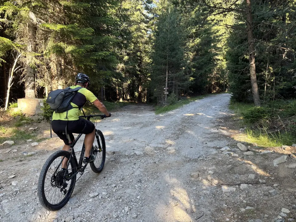
Times use the upper end of the guide’s allowance and exclude long stops. All fourteen rides need transport to a trailhead. Match the terrain grade to your riding skills.
14 routes
Easy · B10
1–2 hours
10.9 km · ↑ 330 m · Return ride
From Treshtenik parking · transport to the start
Leisure riders comfortable climbing on asphalt and ordinary gravel.
View route and mapMedium · B06
1–2 hours
8.9 km · ↑ 320 m · Loop
From Treshtenik parking · transport to the start
Regular cyclists confident braking on a rocky forest descent.
View route and mapExpert · B01
3–6 hours
32.4 km · ↑ 970 m · Loop
From Treshtenik parking · transport to the start
Expert riders on T4 singletrack; expect steep rock and possible carrying.
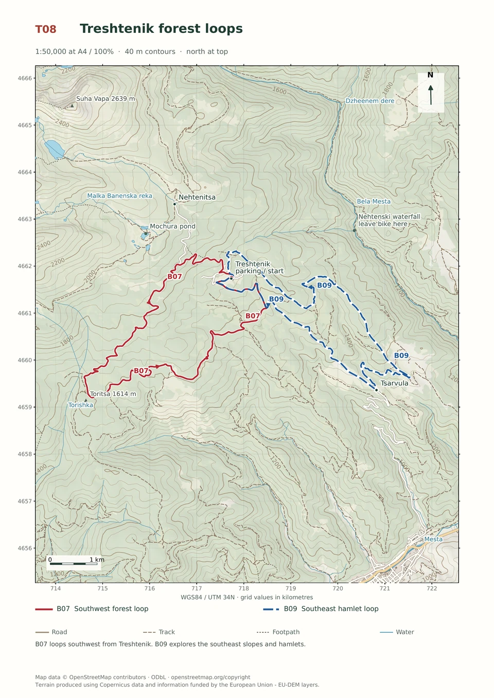
View route and mapMedium · B07
1–3 hours
14.9 km · ↑ 430 m · Loop
From Treshtenik parking · transport to the start
Regular mountain bikers comfortable with ruts, stones and sustained climbs.
View route and mapMedium · B09
1–3 hours
14.6 km · ↑ 530 m · Loop
From Tsarvula · transport to the start
Regular mountain bikers comfortable with 500 m of climbing and rough tracks.
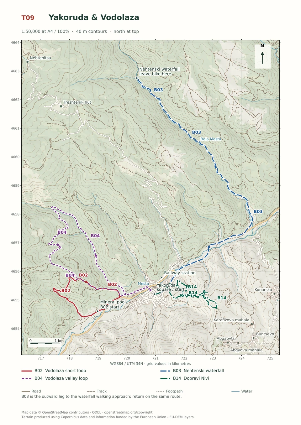
View route and mapEasy · B03
2–4 hours
23.5 km · ↑ 510 m · Return ride
From Yakoruda central square · transport to the start
Leisure cyclists with stamina for 23.5 km and basic gravel-road control.
View route and mapExpert · B02
1–2 hours
6.3 km · ↑ 380 m · Loop
From Yakoruda mineral pool parking · transport to the start
Riders confident on steep, loose descents and exposed turns.
View route and mapExpert · B04
1–3 hours
13.3 km · ↑ 550 m · Loop
From Yakoruda market parking · transport to the start
Riders comfortable with rough tracks, steep sections and a longer loop.
View route and mapExpert · B14
1–2 hours
7.7 km · ↑ 380 m · Loop
From Yakoruda central square · transport to the start
Riders confident descending the steep Vodolaza hillside tracks.
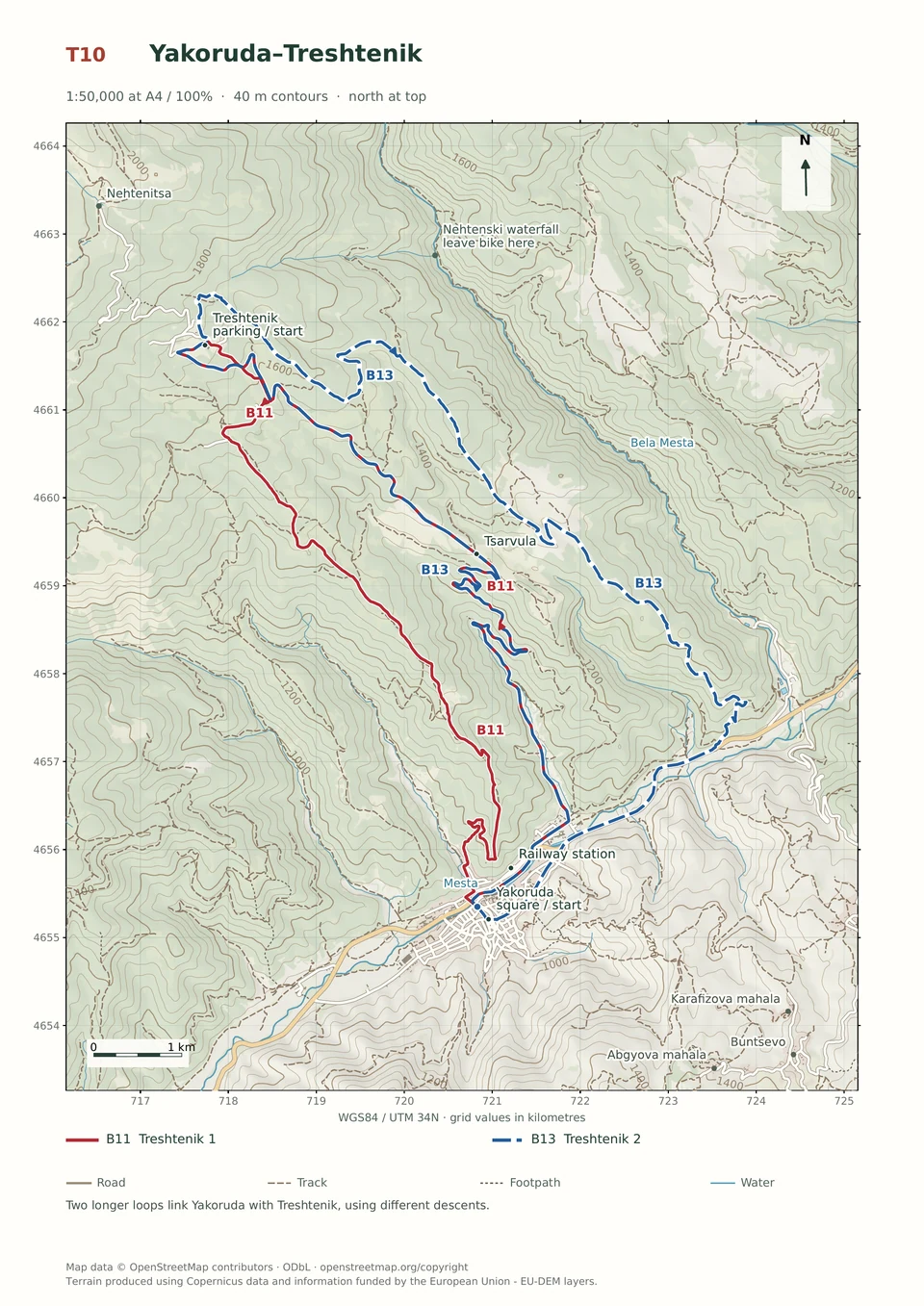
View route and mapExperienced · B11
3–5 hours
24.0 km · ↑ 920 m · Loop
From Yakoruda market parking · transport to the start
Fit riders confident on steep, rutted mountain-road descents.
View route and mapExperienced · B13
3–6 hours
29.3 km · ↑ 980 m · Loop
From Yakoruda market parking · transport to the start
Fit regular riders ready for a long climb and remote forest-road descent.
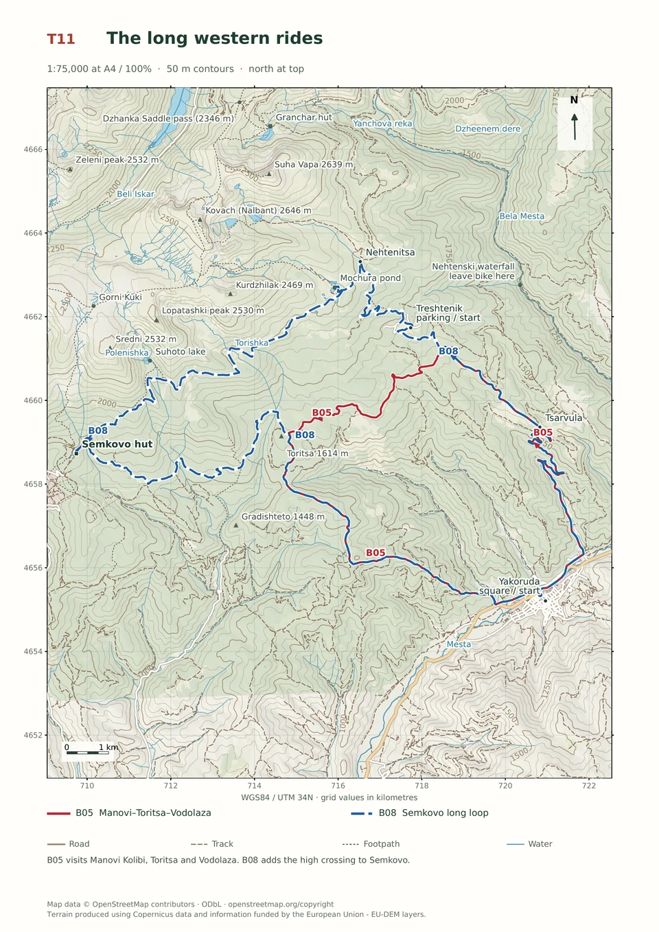
View route and mapExpert · B05
3–5 hours
26.8 km · ↑ 960 m · Loop
From Yakoruda market parking · transport to the start
Fit riders with reliable handling on long, rough mountain tracks.
View route and mapExpert · B08
5–10 hours
47.5 km · ↑ 1680 m · Loop
From Yakoruda market parking · transport to the start
Expert riders with all-day stamina, T4 skills and carrying capacity.
View route and mapExpert · B12
5–10 hours
44.5 km · ↑ 1540 m · Loop
From Yakoruda central square · transport to the start
Expert groups prepared for carrying, blocked tracks and severe erosion.
View route and mapNo mapped routes match these filters. Try more time, another level or reset the filters.
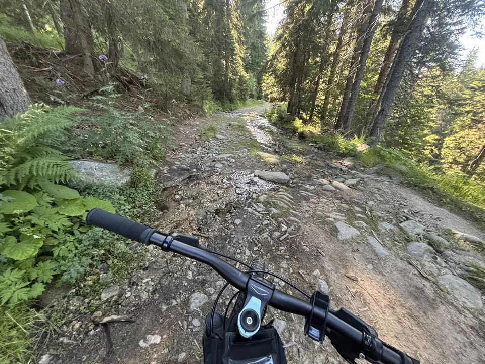
One ride contours high through the forest; another drops into a steep, stony gully. A third finishes with town stairs. This is varied mountain riding, and the number on the kilometre counter tells only half the story. Pick your day by the hardest descent you can handle comfortably, then look at the climbing.
Keep Coliving Semkovo as your accommodation base, with bikes, food and recovery organised there. The fourteen rides below begin at Treshtenik or Yakoruda, so arrange a transfer to the stated start and back from the finish. B01 and B08 pass Semkovo Hut: you can rotate either loop to start there once you have agreed the Coliving connection, adding that approach and return to the totals. Do not cut across forest simply because two lines look close on the map.
| Trailhead | Where to meet | Coordinates |
|---|---|---|
| Treshtenik | Resort parking between the huts | 42.0775° N, 23.6322° E |
| Yakoruda market | Central parking between the main road and town centre; occupied by the market on Saturdays | 42.0192° N, 23.6672° E |
| Yakoruda square | Central town square | 42.0179° N, 23.6687° E |
| Yakoruda mineral pool | Parking beside the municipal pool and narrow-gauge railway halt | 42.0131° N, 23.6446° E |
| Tsarvula | Locality on the Yakoruda–Treshtenik road | 42.0553° N, 23.6686° E |
For gentler surfaces, begin with B10 Mochura or B03 Nehtenski Waterfall; both have qualifications, from steep climbing to road traffic. B06, B07 and B09 suit riders at ease on uneven forest roads. B01, B02, B04 and B14 add demanding singletrack. B05, B08 and B13 are substantial days with enough climbing to make lunch a necessity.
Riding levels. Easy means straightforward asphalt or gravel, though the climb may still test your legs. Medium suits regular mountain bikers on rough forest roads. Experienced calls for stamina and confident handling on steep, rutted tracks. Expert includes hard singletrack, severe erosion or sections to push or carry. Choose by the hardest section, not just the distance.
Reading the cards: R1 is asphalt, R2 ordinary dirt road, R3 difficult dirt road, T3 technical trail and T4 hard singletrack. X means unavoidable pushing or carrying. An R2 road can still be steep, loose or rutted. The separate KFN effort grade is low up to 4, medium at 5–7 and high from 8; it does not measure every obstacle or navigational problem. Times are broad riding allowances. Add transfers, long stops and repairs.
Carry food, water, a pump, repair kit and the means to deal with a puncture away from a road. Check brakes before a big descent. Fountains are useful refill opportunities when flowing, but leave with enough water for the next leg. Forest tracks change after storms and logging, and an unsigned fork can cost more time than a climb. Use the route map alongside the kilometre cues; the latter begin at the stated trailhead.
Several local lines run downhill from the resort towards the bear park, Rila Fun Park and Belitsa. They can make appealing guided days, but their exact start and alignment need agreeing locally before departure. All figures below are one way. Arrange a collection or reserve energy and daylight for the uphill return.
| Destination | Distance and height change | Practical shape of the day |
|---|---|---|
| Bear Park | 11.1 km · 96 m ascent / 577 m descent | Experienced · Predominantly downhill; allow separate time for the sanctuary and a pickup. |
| Rila Fun Park | About 7.5 km · 120 m ascent / 545 m descent | Experienced · A shorter descent with an activity stop; settle bike storage and the return. |
| Belitsa, longer line | About 20.5 km · 75 m ascent / 890 m descent | Experienced · Mostly downhill, with transport needed from the valley. |
| Belitsa, shorter line | About 16 km · 97 m ascent / 917 m descent | Expert · A different, more technically demanding alignment; not a shortcut version of the row above. |
| Macedonia Hut, from Semkovo Hut | About 17.4 km · 671 m ascent / 254 m descent | Experienced · A difficult net climb; confirm the authorised park corridor and arrange a hut stay or return. |
The mountain connection towards Dobarsko — Experienced also needs a current local route briefing. Do not confuse it with B14's Dobrevi Nivi, east of Yakoruda. These possibilities are worth discussing with a guide; they are not additional fully described route cards.
Use designated cycling routes and respect closures. Hiking marks alone do not establish bicycle access, and altitude alone does not decide whether a ride is permitted. B01 and B08 require advance coordination for the below-Suhoto trail; B12 needs confirmation of both its upper access and the obstructed-road bypass. Provide your planned route, date, group size and whether you will use ordinary or electric bikes.
The Bodrost → Macedonia Hut → Karaalanitsa → Semkovo corridor has been designated for cycling and horse riding. Ask for its current signed alignment and any closures; an old Dinkov Dol track is not interchangeable with that corridor. The first opened section was about 25 km; the longer 80 km link towards Belmeken was a wider project, not a distance to assume open and rideable today.
Rila National Park Directorate: +359 73 880537. Duty number: +359 884 111400. Email: delovodstvo@rilanationalpark.bg.