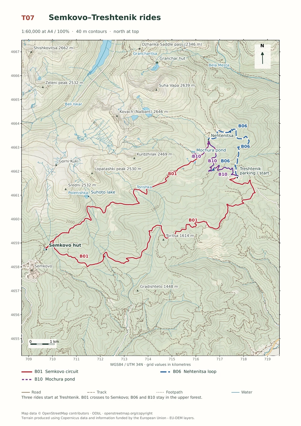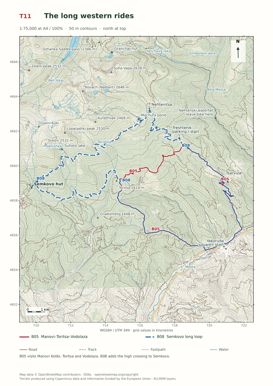
Expert · B08
Yakoruda–Treshtenik–Semkovo–Vodolaza
5–10 hours
47.5 km · ↑ 1680 m · Loop
From Yakoruda market parking · transport to the start
Expert riders with all-day stamina, T4 skills and carrying capacity.
View route and mapA long mountain circuit follows the Byala Mesta and Nehtenitsa ridge, with carrying, an obstructed upper connection and a severely eroded final descent.
Expert groups prepared for carrying, blocked tracks and severe erosion. Arrange transfers to and from Yakoruda’s central square.
Follow the line marked B12. Loop.

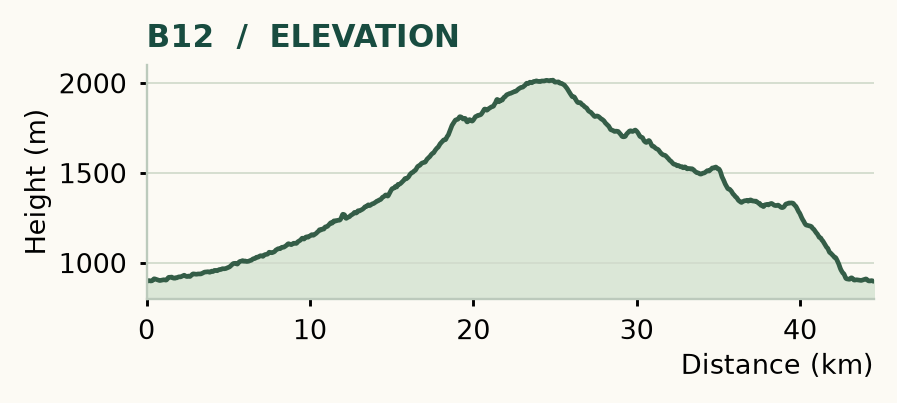
Distance and ascent above follow the mapped route using terrain-model heights. Elevation: 897–2016 m.
44.5 km · 1,210 m ascent · 5–10 hours · advanced adventure terrain, R1/R2/R3/X · KFN7. Start and finish at Yakoruda's central square.
Mapped profile: 44.52 km, 1,540 m terrain-model ascent. Original guide estimate: 44.5 km, 1,210 m ascent. These are separately published figures; the profile uses terrain-model heights.
Complete ride · 44.5 km. Rounded labels on the original map or profile may differ slightly. The original guide estimates are retained here for comparison; use the full figures for your chosen starting point.
Who it’s for: Expert. Expert groups prepared for carrying, blocked tracks and severe erosion.
The name fits. This route includes carrying, blocked tracks and a severely eroded final descent; its numerical effort grade tells you less than those three facts. Keep it for an experienced group with a confirmed route and access agreement. It is unsuitable as a spontaneous ride chosen over breakfast.
Route outline: follow the fish-farm turn at 4.1 km and the Byala Mesta valley. The good road ends around 14.7 km, followed by the Ropalitsa ascent. A meadow near 18.3 km precedes an obstructed old road and a steep, indistinct bypass towards the Belmeken–Nehtenitsa road. Continue along the Nehtenitsa ridge, through Treshtenik, Kyorovi and Yurcheni Kolibi, then Grashkina Mogila before the difficult descent to Yakoruda.
The obstructed upper connection and off-road bypass need explicit confirmation from the park before attempting them. Fallen trees can make carrying unavoidable, and the final erosion can be dangerous even to skilled riders. Turn back if the bypass is unclear or closed. Take a full day's food and generous water; 2 litres is only a starting allowance, not a ceiling for a long, hot day.
Expert · B08
5–10 hours
47.5 km · ↑ 1680 m · Loop
From Yakoruda market parking · transport to the start
Expert riders with all-day stamina, T4 skills and carrying capacity.
View route and mapExpert · B01
3–6 hours
32.4 km · ↑ 970 m · Loop
From Treshtenik parking · transport to the start
Expert riders on T4 singletrack; expect steep rock and possible carrying.
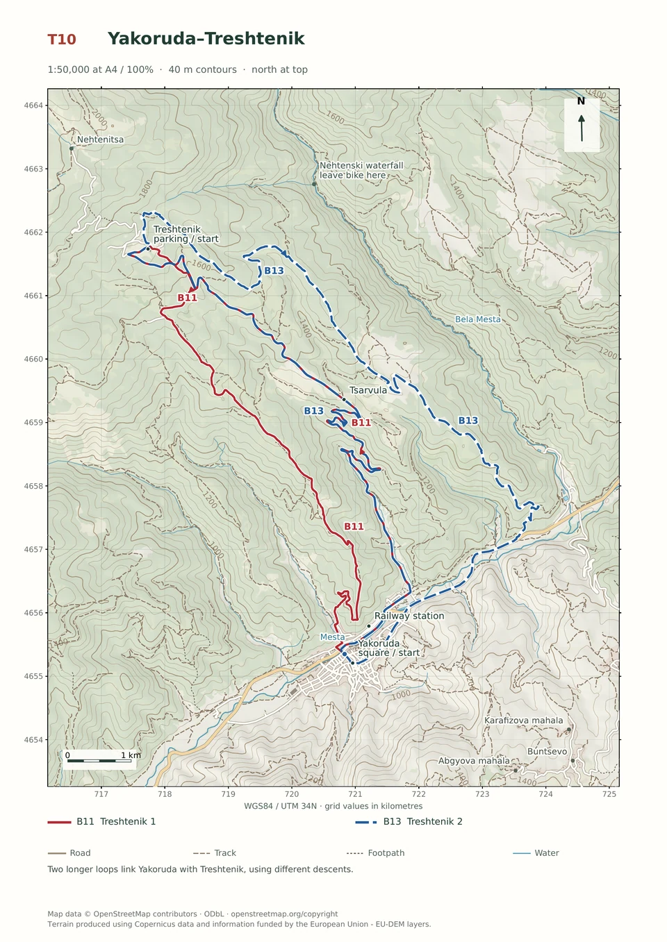
View route and mapExperienced · B13
3–6 hours
29.3 km · ↑ 980 m · Loop
From Yakoruda market parking · transport to the start
Fit regular riders ready for a long climb and remote forest-road descent.
View route and map