Experienced · B13
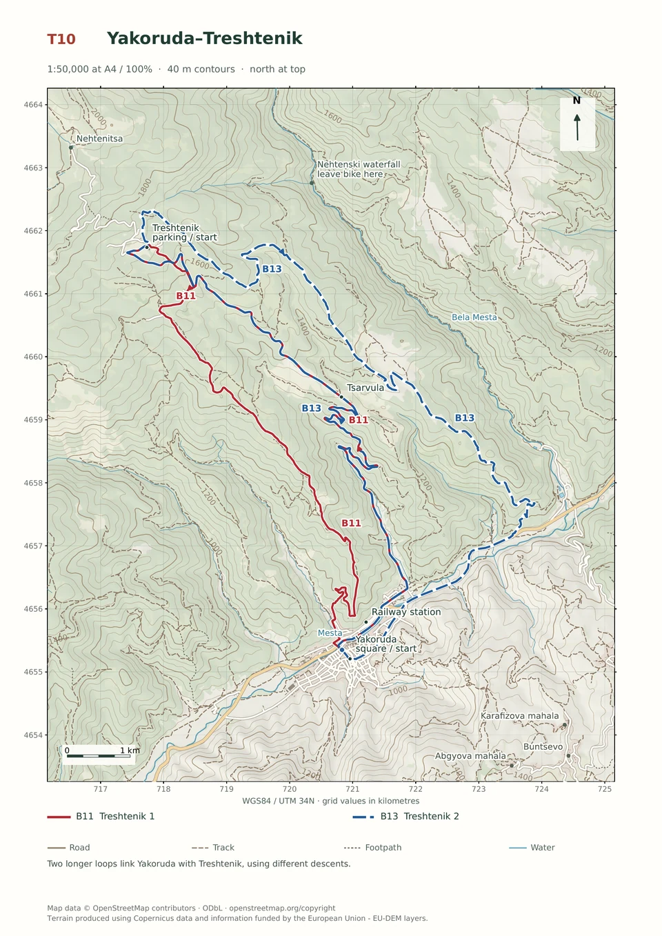
Yakoruda–Treshtenik 2
3–6 hours
29.3 km · ↑ 980 m · Loop
From Yakoruda market parking · transport to the start
Fit regular riders ready for a long climb and remote forest-road descent.
View route and mapContour below Suhoto Lake before a steep, stony descent to Semkovo Hut and a forest-road return through Toritsa and Manovi Kolibi.
Expert riders on T4 singletrack; expect steep rock and possible carrying. Arrange transfers to and from Treshtenik. A Semkovo Hut start needs an agreed Coliving connection, added to the route totals.
Follow the line marked B01. Loop.

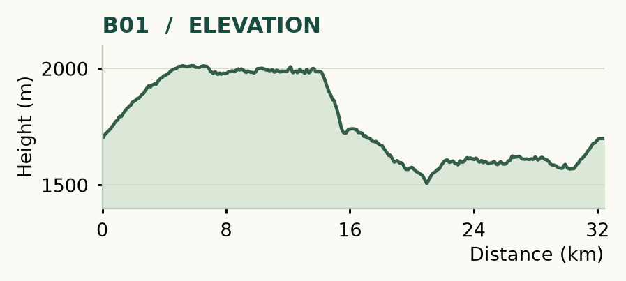
Distance and ascent above follow the mapped route using terrain-model heights. Elevation: 1507–2013 m.
32.4 km · 680 m ascent · 3–6 hours · advanced, R1/R2/T4 · medium effort, KFN5. Start and finish at Treshtenik parking.
Mapped profile: 32.43 km, 970 m terrain-model ascent. Original guide estimate: 32.4 km, 680 m ascent. These are separately published figures; the profile uses terrain-model heights.
Complete ride · 32.4 km. Rounded labels on the original map or profile may differ slightly. The original guide estimates are retained here for comparison; use the full figures for your chosen starting point.
Who it’s for: Expert. Expert riders on T4 singletrack; expect steep rock and possible carrying.
This is the high forest ride to build a trip around if you enjoy technical descending. The waterworks road offers a long contour across the mountain; the approach to Semkovo Hut then changes the mood completely, dropping through a steep, stony gully.
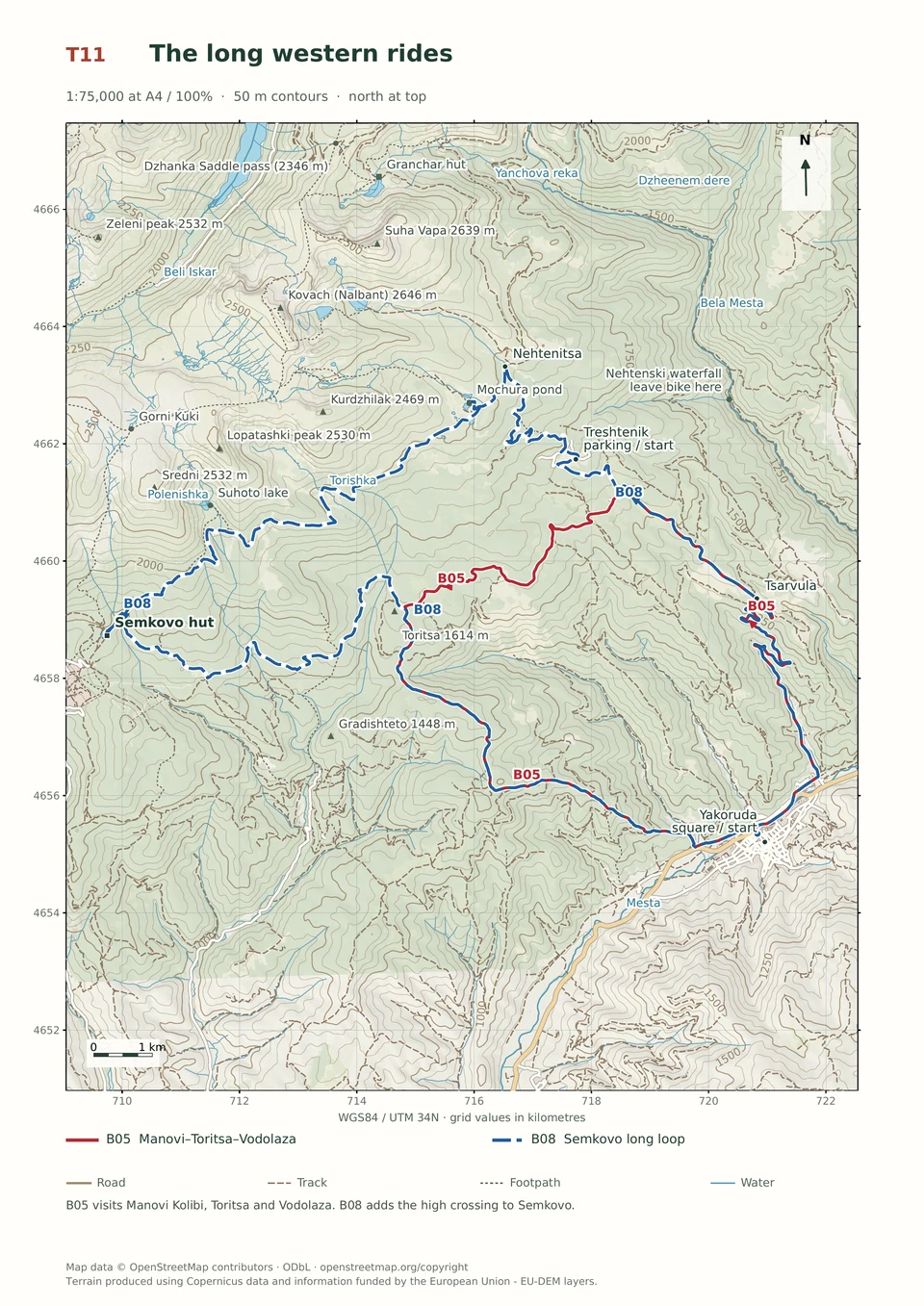
Ride: climb to Nehtenitsa, turning left onto the waterworks road at 4.1 km. Include the Mochura spur near 5 km, then follow the contour west. Around 13 km, the road becomes trail. At 14.1 km, join the yellow/green-marked descent, and turn right towards Semkovo Hut at 15.6 km. Return east by road; at 18.9 km, take the sharp left, cross the stream and climb. Leave the red markings right at 24 km, continue through the Toritsa area and Manovi Kolibi, then join the asphalt at 30.5 km. Turn right near 32.1 km for the parking.
The route runs below Suhoto Lake, without visiting its shore. Its singletrack lies in the national park and needs prior coordination with the park Directorate; a hiking waymark is not cycling permission. See the contact box at the end of this chapter. Choose snow-free summer conditions, carry lunch and take the final gully seriously. Semkovo Hut is a useful stop before the return leg.
Experienced · B13
3–6 hours
29.3 km · ↑ 980 m · Loop
From Yakoruda market parking · transport to the start
Fit regular riders ready for a long climb and remote forest-road descent.
View route and mapExperienced · B11
3–5 hours
24.0 km · ↑ 920 m · Loop
From Yakoruda market parking · transport to the start
Fit riders confident on steep, rutted mountain-road descents.
View route and mapExpert · B05
3–5 hours
26.8 km · ↑ 960 m · Loop
From Yakoruda market parking · transport to the start
Fit riders with reliable handling on long, rough mountain tracks.
View route and map