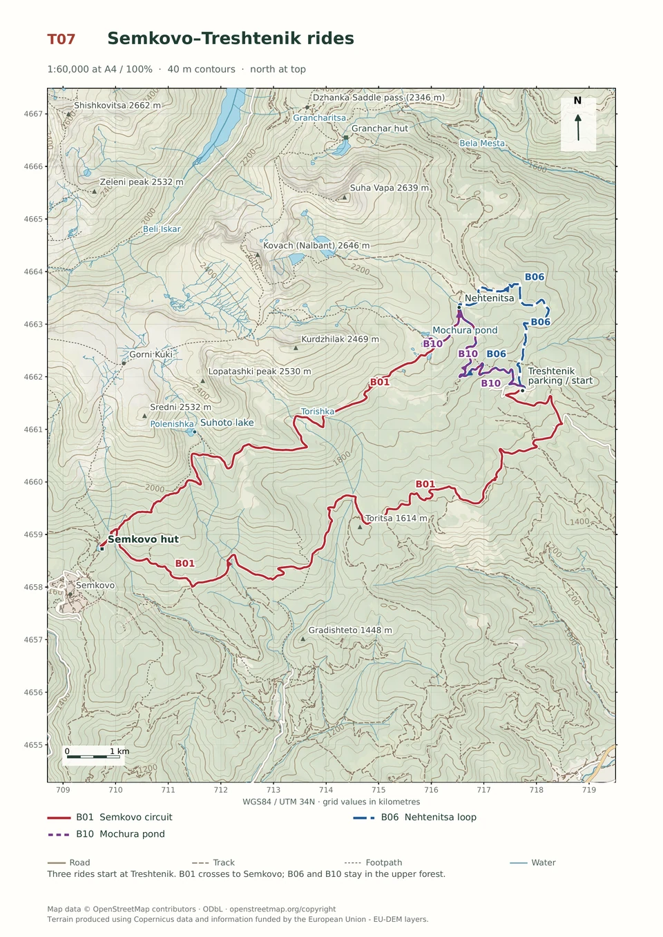
Expert · B05
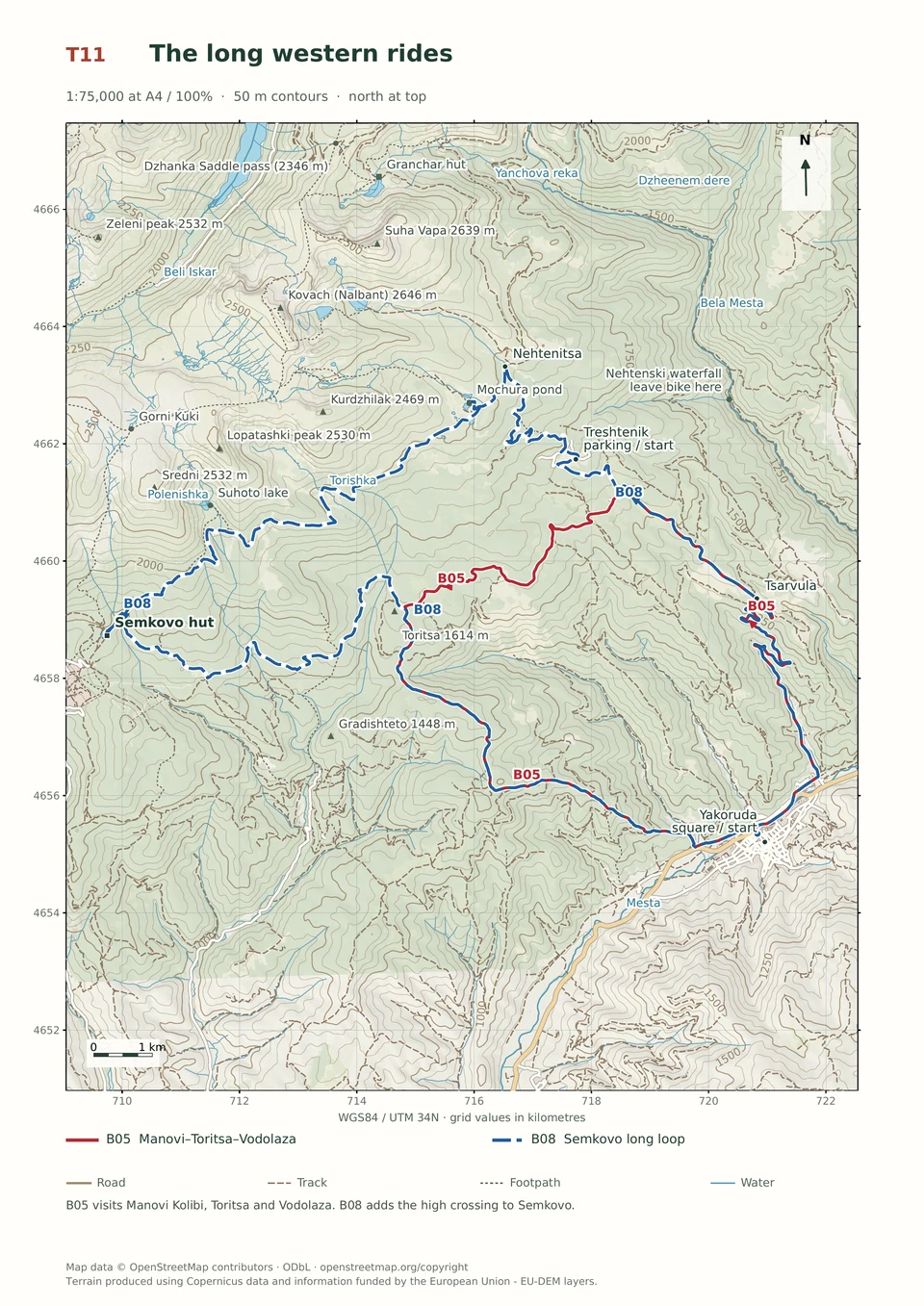
Manovi Kolibi–Toritsa–Vodolaza
3–5 hours
26.8 km · ↑ 960 m · Loop
From Yakoruda market parking · transport to the start
Fit riders with reliable handling on long, rough mountain tracks.
View route and mapClimb on asphalt to Treshtenik, then return to Yakoruda on rough, branching mountain roads with deep ruts and faint continuations.
Fit riders confident on steep, rutted mountain-road descents. Arrange transfers to and from Yakoruda; the market parking is occupied on Saturdays.
Follow the line marked B11. Loop.

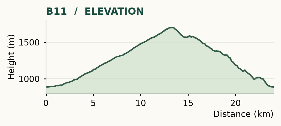
Distance and ascent above follow the mapped route using terrain-model heights. Elevation: 887–1701 m.
24 km · 825 m ascent · 3–5 hours · advanced roads, R1/R2/R3 · medium effort, KFN6. Start and finish at Yakoruda market parking.
Mapped profile: 24.04 km, 920 m terrain-model ascent. Original guide estimate: 24 km, 825 m ascent. These are separately published figures; the profile uses terrain-model heights.
Complete ride · 24.0 km. Rounded labels on the original map or profile may differ slightly. The original guide estimates are retained here for comparison; use the full figures for your chosen starting point.
Who it’s for: Experienced. Fit riders confident on steep, rutted mountain-road descents.
Wide tracks can still make tough riding. This loop saves its awkward work for a rough, branching descent with deep ruts and faint continuations. Choose it if you enjoy that kind of exploration; B13 is the more approachable of the two Treshtenik loops.
Ride: climb the asphalt to Treshtenik, leaving it right towards the hut at 13.1 km. Descend through the rough bungalow roads, briefly rejoin the main road and continue towards Manovi Kolibi. At 15.4 km, go straight uphill off the main track. Near 17.9 km, take the faint straight continuation into the descent. Stay with the mapped line through the branching roads, pass the building and fence near 22 km, and reach Dzhebre Street at 23.4 km for the return to the market.
Fresh forestry work can change ruts and junctions quickly. Slow down where the main line becomes unclear rather than following whichever track looks widest. There are fountains on the climb; carry food unless a hut meal has been arranged.
Expert · B05
3–5 hours
26.8 km · ↑ 960 m · Loop
From Yakoruda market parking · transport to the start
Fit riders with reliable handling on long, rough mountain tracks.
View route and mapExpert · B01
3–6 hours
32.4 km · ↑ 970 m · Loop
From Treshtenik parking · transport to the start
Expert riders on T4 singletrack; expect steep rock and possible carrying.
View route and mapEasy · B03
2–4 hours
23.5 km · ↑ 510 m · Return ride
From Yakoruda central square · transport to the start
Leisure cyclists with stamina for 23.5 km and basic gravel-road control.
View route and map