Medium · B07
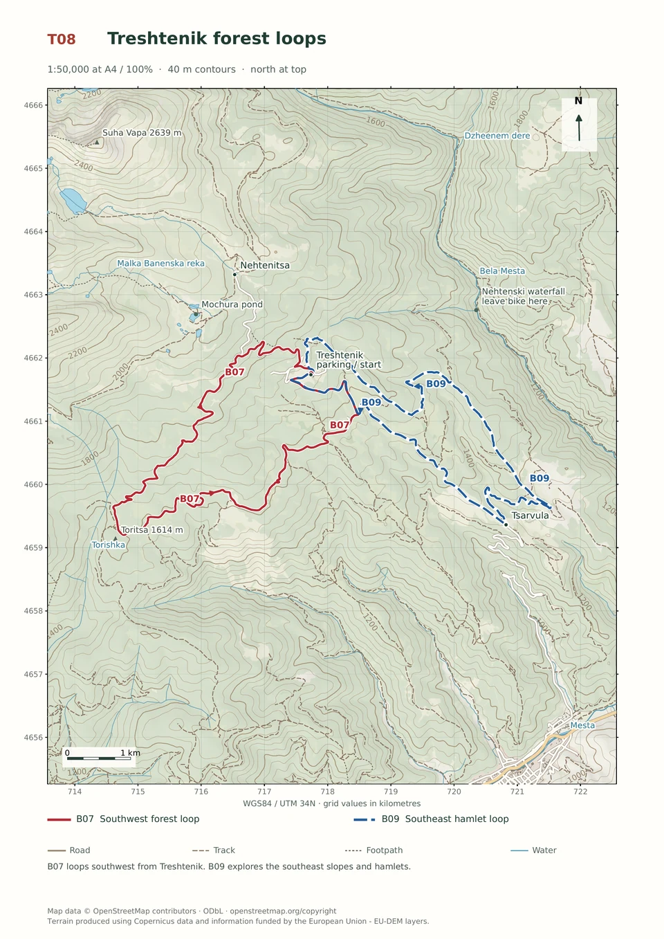
Treshtenik Southwest Loop
1–3 hours
14.9 km · ↑ 430 m · Loop
From Treshtenik parking · transport to the start
Regular mountain bikers comfortable with ruts, stones and sustained climbs.
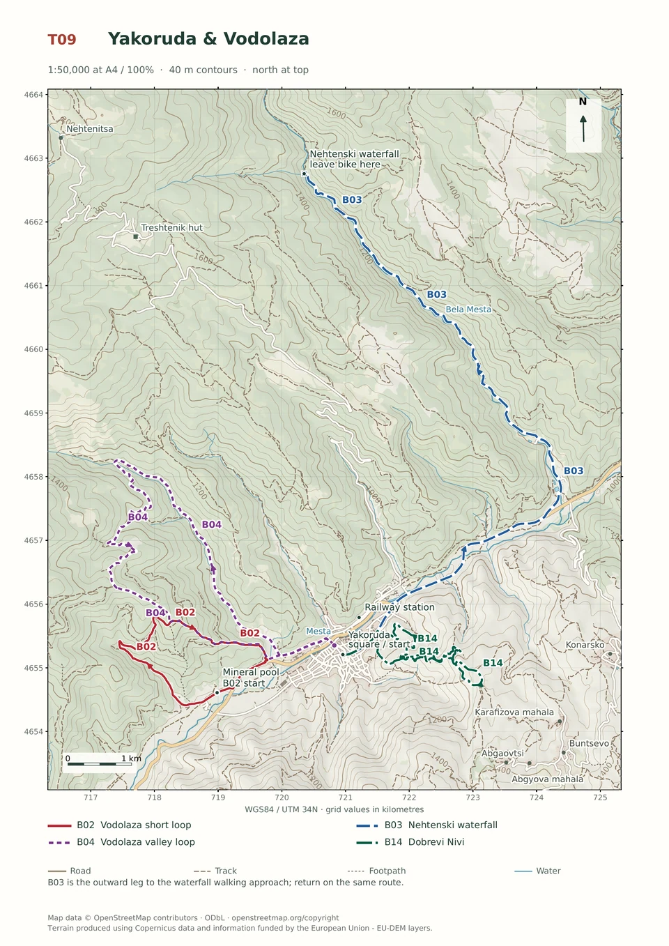
View route and mapRide upstream beside the Byala Mesta to Nehtenski Waterfall, leaving the bike for the final walking approach before retracing the route.
Leisure cyclists with stamina for 23.5 km and basic gravel-road control. Arrange transfers to and from Yakoruda’s central square.
Follow the line marked B03. Return ride.

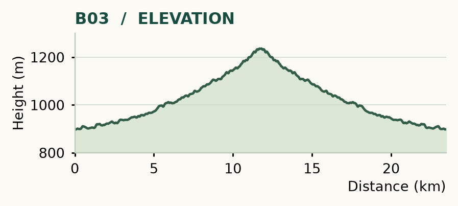
Distance and ascent above follow the mapped route using terrain-model heights. Elevation: 897–1236 m.
23.5 km return · 310 m ascent · 2–4 hours · low technical demand, R1/R2 · low effort, KFN3.5. Start and finish at Yakoruda's central square.
Mapped profile: 23.49 km, 510 m terrain-model ascent. Original guide estimate: 23.5 km return, 310 m ascent. These are separately published figures; the profile uses terrain-model heights.
Complete ride · 23.5 km. Rounded labels on the original map or profile may differ slightly. The original guide estimates are retained here for comparison; use the full figures for your chosen starting point.
Who it’s for: Easy. Leisure cyclists with stamina for 23.5 km and basic gravel-road control.
An upstream ride and a waterfall make a straightforward outing, with an easier riding surface than most of the mountain loops. The first public-road section is its least relaxing part: expect traffic, including trucks.
Ride: leave the square northeast along Tsar Boris III, join the Yundola road and turn left at the fish-farm signs around 4.1 km. Cross the bridge, then go left upstream beside the Byala Mesta. Near 11.7 km, a bridge and signs mark the waterfall approach. Leave the bicycle and continue on foot; retrace the whole route to Yakoruda.
Allow roughly 300 m of walking at the waterfall. The lower viewing approach is the easier choice; the upper path is rockier and more exposed. The distance above includes the return, even though the route map shows the outward line. Do not ride the pedestrian approach.
Medium · B07
1–3 hours
14.9 km · ↑ 430 m · Loop
From Treshtenik parking · transport to the start
Regular mountain bikers comfortable with ruts, stones and sustained climbs.
View route and mapMedium · B09
1–3 hours
14.6 km · ↑ 530 m · Loop
From Tsarvula · transport to the start
Regular mountain bikers comfortable with 500 m of climbing and rough tracks.
View route and mapExpert · B04
1–3 hours
13.3 km · ↑ 550 m · Loop
From Yakoruda market parking · transport to the start
Riders comfortable with rough tracks, steep sections and a longer loop.
View route and map