Medium · B09
Treshtenik Southeast Hamlet Loop
1–3 hours
14.6 km · ↑ 530 m · Loop
From Tsarvula · transport to the start
Regular mountain bikers comfortable with 500 m of climbing and rough tracks.
View route and mapForest roads link Treshtenik and Manovi Kolibi on a loop whose damaged bridge needs checking before you commit.
Regular mountain bikers comfortable with ruts, stones and sustained climbs. Arrange transfers to and from Treshtenik parking.
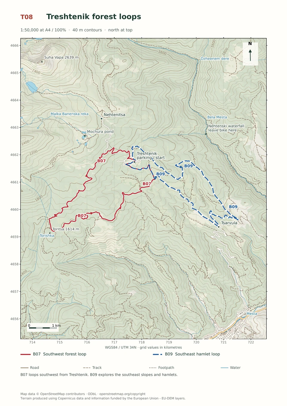
Follow the line marked B07. Loop.

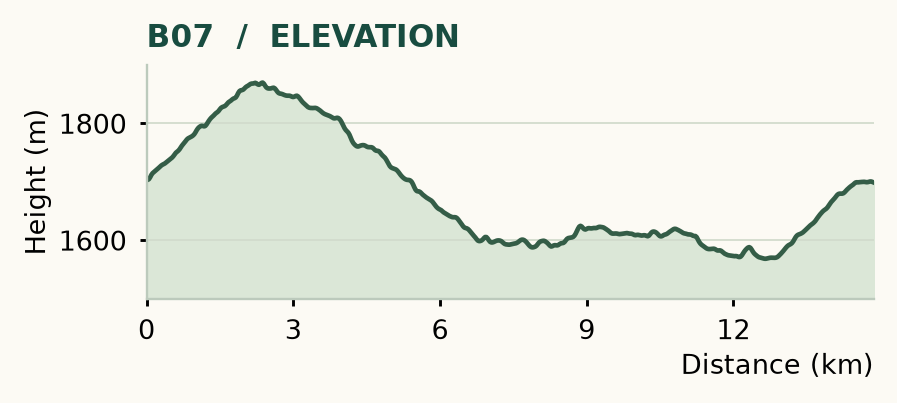
Distance and ascent above follow the mapped route using terrain-model heights. Elevation: 1568–1870 m.
14.9 km · 340 m ascent · 1–3 hours · moderate technical demand, R1/R2 · low effort, KFN4. Start and finish at Treshtenik parking.
Mapped profile: 14.87 km, 430 m terrain-model ascent. Original guide estimate: 14.9 km, 340 m ascent. These are separately published figures; the profile uses terrain-model heights.
Complete ride · 14.9 km. Rounded labels on the original map or profile may differ slightly. The original guide estimates are retained here for comparison; use the full figures for your chosen starting point.
Who it’s for: Medium. Regular mountain bikers comfortable with ruts, stones and sustained climbs.
Forest roads, small climbs and the hamlet of Manovi Kolibi give this ride an unhurried shape. The catch is a damaged bridge: check its condition before committing to the loop.
Ride: turn right uphill at 0.4 km, then leave the asphalt left at about 2.2 km, following the red-marked Semkovo road. The troublesome bridge is near 4.4 km. Beyond the crossing, leave the red marks at 6.4 km, turning left beside a hut. At 6.8 km, continue straight and then left onto the forest-road circuit towards Manovi Kolibi. Join the asphalt at 12.9 km and climb back, turning right into the resort near 14.5 km.
The bridge has been rotten and collapsed; an upstream crossing is not a dependable alternative in high water. Turn back if you cannot cross safely. There is a fountain at Manovi Kolibi, and the final paved climb is steeper than tired legs may appreciate.
Medium · B09
1–3 hours
14.6 km · ↑ 530 m · Loop
From Tsarvula · transport to the start
Regular mountain bikers comfortable with 500 m of climbing and rough tracks.
View route and mapExpert · B04
1–3 hours
13.3 km · ↑ 550 m · Loop
From Yakoruda market parking · transport to the start
Riders comfortable with rough tracks, steep sections and a longer loop.
View route and mapEasy · B10
1–2 hours
10.9 km · ↑ 330 m · Return ride
From Treshtenik parking · transport to the start
Leisure riders comfortable climbing on asphalt and ordinary gravel.
View route and map