Medium · B07
Treshtenik Southwest Loop
1–3 hours
14.9 km · ↑ 430 m · Loop
From Treshtenik parking · transport to the start
Regular mountain bikers comfortable with ruts, stones and sustained climbs.
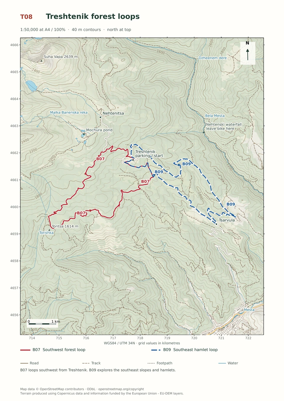
View route and mapClimb from Tsarvula through Treshtenik and mountain hamlets, then descend below Grashkina Mogila on rough, sometimes steep tracks.
Regular mountain bikers comfortable with 500 m of climbing and rough tracks. Arrange transfers to and from Tsarvula. Treshtenik is another possible start, with different kilometre references.
Follow the line marked B09. Loop.

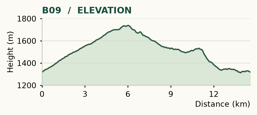
Distance and ascent above follow the mapped route using terrain-model heights. Elevation: 1313–1738 m.
14.6 km · 500 m ascent · 1–3 hours · moderate technical demand, R1/R2 · medium effort, KFN5. Start and finish at Tsarvula. Treshtenik is another possible start on the same loop.
Mapped profile: 14.56 km, 530 m terrain-model ascent. Original guide estimate: 14.6 km, 500 m ascent. These are separately published figures; the profile uses terrain-model heights.
Complete ride · 14.6 km. Rounded labels on the original map or profile may differ slightly. The original guide estimates are retained here for comparison; use the full figures for your chosen starting point.
Who it’s for: Medium. Regular mountain bikers comfortable with 500 m of climbing and rough tracks.
This is a ride through lived-in mountain country: forest, scattered houses, meadows and old tracks across the ridges. The biggest technical pinch comes below Grashkina Mogila, where a short, steep descent is often better walked.
Ride: climb the road from Tsarvula. At 5 km, turn right off the asphalt towards Treshtenik Hut, then take the bungalow track. Go right downhill at 6 km and left near 6.7 km, passing Kausha and Kyorovi Kolibi. In Yurcheni Kolibi, 8.2 km, turn sharply left, then left again after 300 m. At 9.9 km, leave the main road straight/right for Grashkina Mogila. Join the larger road at 12.1 km, take its right-hand hairpin at 12.5 km, then continue via the Gramadna crossing to Tsarvula.
Expect roughly 200 m of steep, eroded descending below the top. Take lunch and use the roadside fountains on the climb if flowing. Starting at Treshtenik keeps the total distance but changes all the kilometre references above.
Medium · B07
1–3 hours
14.9 km · ↑ 430 m · Loop
From Treshtenik parking · transport to the start
Regular mountain bikers comfortable with ruts, stones and sustained climbs.
View route and mapExpert · B04
1–3 hours
13.3 km · ↑ 550 m · Loop
From Yakoruda market parking · transport to the start
Riders comfortable with rough tracks, steep sections and a longer loop.
View route and mapEasy · B10
1–2 hours
10.9 km · ↑ 330 m · Return ride
From Treshtenik parking · transport to the start
Leisure riders comfortable climbing on asphalt and ordinary gravel.
View route and map