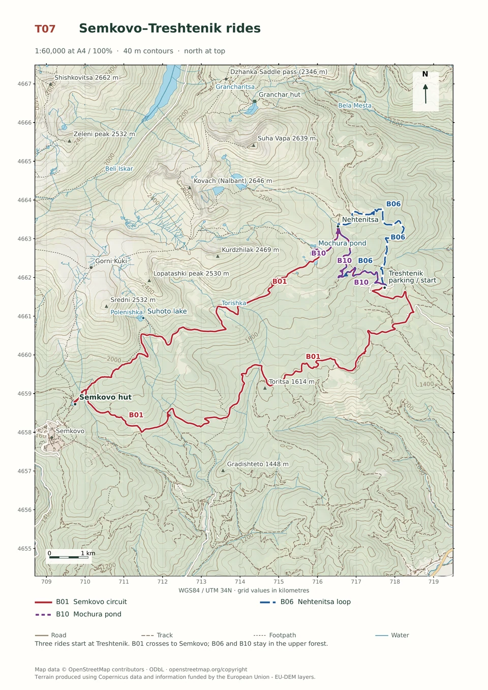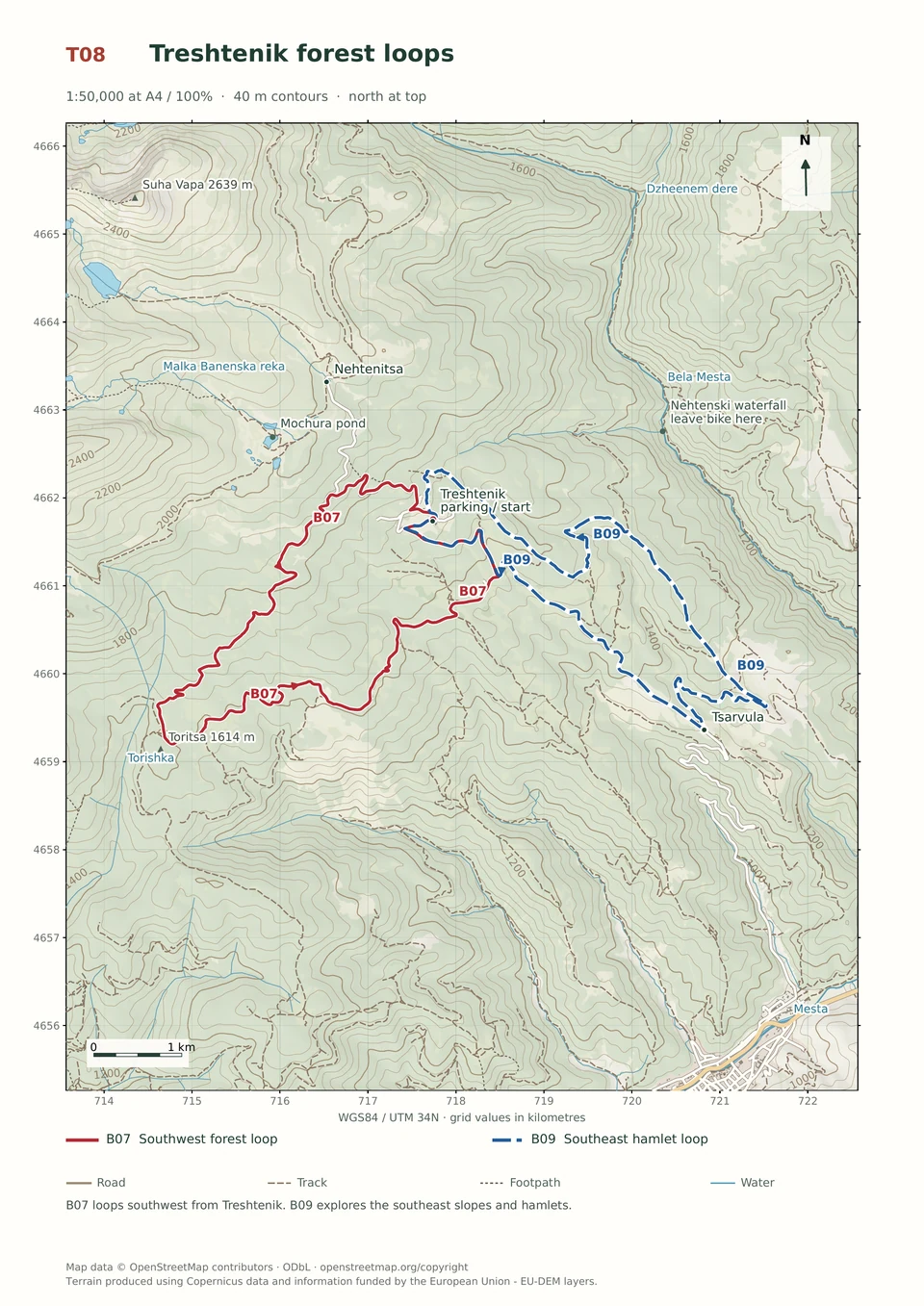
Medium · B07
Treshtenik Southwest Loop
1–3 hours
14.9 km · ↑ 430 m · Loop
From Treshtenik parking · transport to the start
Regular mountain bikers comfortable with ruts, stones and sustained climbs.
View route and mapApproach Vodolaza through the Yakorudchitsa valley before joining its demanding technical descent back towards Yakoruda.
Riders comfortable with rough tracks, steep sections and a longer loop. Arrange transfers to and from Yakoruda; the market parking is occupied on Saturdays.
Follow the line marked B04. Loop.

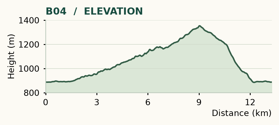
Distance and ascent above follow the mapped route using terrain-model heights. Elevation: 885–1353 m.
13.3 km · 440 m ascent · 1–3 hours · advanced, R1/R2/T4 · medium effort, KFN5. Start and finish at Yakoruda market parking.
Mapped profile: 13.28 km, 550 m terrain-model ascent. Original guide estimate: 13.3 km, 440 m ascent. These are separately published figures; the profile uses terrain-model heights.
Complete ride · 13.3 km. Rounded labels on the original map or profile may differ slightly. The original guide estimates are retained here for comparison; use the full figures for your chosen starting point.
Who it’s for: Expert. Riders comfortable with rough tracks, steep sections and a longer loop.
This version eases into the hills beside the Yakorudchitsa before delivering the same demanding Vodolaza finish. The gentler beginning is welcome, but it does not make the descent easier.
Ride: follow the railway-side street from the market and cross at about 1.2 km into the Yakorudchitsa valley. Cross left over the river around 5.5 km. Take the faint left-hand connector at 6.7 km, then a sharp left at 7.7 km and the leftmost climbing road at 8.1 km. Descending begins around 9.1 km. Turn left near 10.3 km, then shortly right onto the trail. Cross the road near 11.2 km, reach the railway edge around 12.1 km, and return through the lawful crossing to town.
The 200 m connector at 6.7 km can be overgrown and obstructed by fallen trees. Carry all your water and allow time to inspect the way through. Avoid Saturday market parking and take extra care at the railway and road crossings.
Medium · B07
1–3 hours
14.9 km · ↑ 430 m · Loop
From Treshtenik parking · transport to the start
Regular mountain bikers comfortable with ruts, stones and sustained climbs.
View route and mapMedium · B09
1–3 hours
14.6 km · ↑ 530 m · Loop
From Tsarvula · transport to the start
Regular mountain bikers comfortable with 500 m of climbing and rough tracks.
View route and mapEasy · B10
1–2 hours
10.9 km · ↑ 330 m · Return ride
From Treshtenik parking · transport to the start
Leisure riders comfortable climbing on asphalt and ordinary gravel.
View route and map