Medium · B06
Treshtenik–Nehtenitsa Forest Loop
1–2 hours
8.9 km · ↑ 320 m · Loop
From Treshtenik parking · transport to the start
Regular cyclists confident braking on a rocky forest descent.
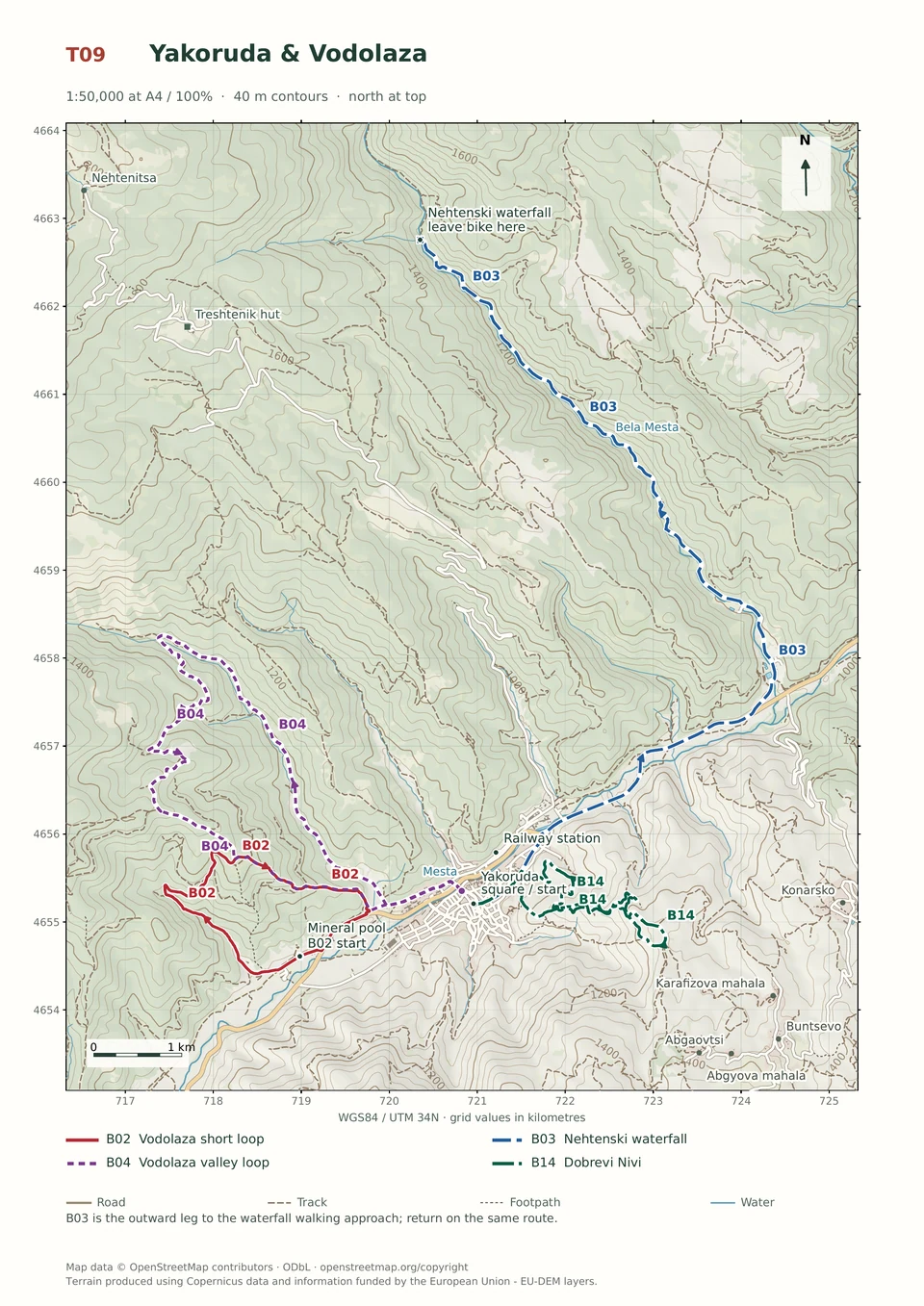
View route and mapA steep paved climb and ordinary gravel lead from Treshtenik to Mochura Pond, with a picnic stop and a return along the same route.
Leisure riders comfortable climbing on asphalt and ordinary gravel. Arrange transfers to and from Treshtenik parking.
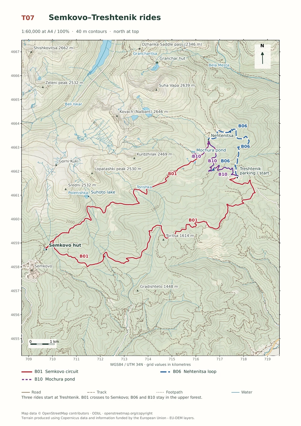
Follow the line marked B10. Return ride.

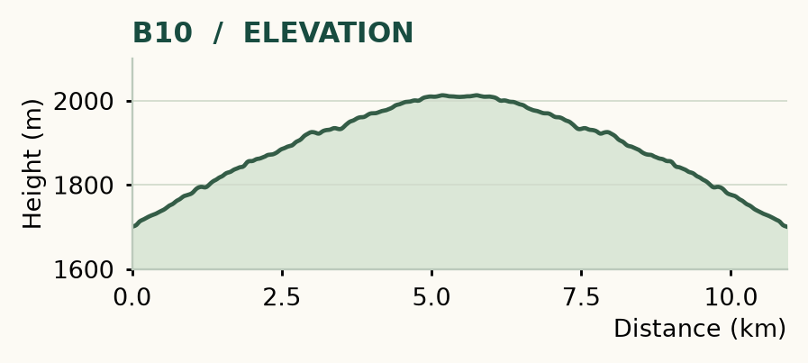
Distance and ascent above follow the mapped route using terrain-model heights. Elevation: 1700–2013 m.
10.9 km return · 310 m ascent · 1–2 hours · low technical demand, R1/R2 · low effort, KFN4. Start and finish at Treshtenik parking.
Mapped profile: 10.94 km, 330 m terrain-model ascent. Original guide estimate: 10.9 km return, 310 m ascent. These are separately published figures; the profile uses terrain-model heights.
Complete ride · 10.9 km. Rounded labels on the original map or profile may differ slightly. The original guide estimates are retained here for comparison; use the full figures for your chosen starting point.
Who it’s for: Easy. Leisure riders comfortable climbing on asphalt and ordinary gravel.
Mochura is the gentle introduction with a sting in its tail: the riding surface is approachable, but the paved climb is steep. Riders who are happy going uphill get a high-country pond and a picnic stop without a technical descent.
Ride: leave the parking, turn right uphill at 0.4 km and stay on the asphalt at 2.3 km. At Nehtenitsa, 4.1 km, turn left onto the gravel waterworks road. Take the right-hand spur near 5 km, then turn right again about 150 m later to reach the pond. Return exactly the same way.
There is a fountain at Nehtenitsa and picnic seating by the pond. Keep your speed down on the paved descent, follow signed access near the park boundary and take enough food to make the stop worthwhile.
Medium · B06
1–2 hours
8.9 km · ↑ 320 m · Loop
From Treshtenik parking · transport to the start
Regular cyclists confident braking on a rocky forest descent.
View route and mapExpert · B02
1–2 hours
6.3 km · ↑ 380 m · Loop
From Yakoruda mineral pool parking · transport to the start
Riders confident on steep, loose descents and exposed turns.
View route and mapExpert · B14
1–2 hours
7.7 km · ↑ 380 m · Loop
From Yakoruda central square · transport to the start
Riders confident descending the steep Vodolaza hillside tracks.
View route and map