Easy · B10
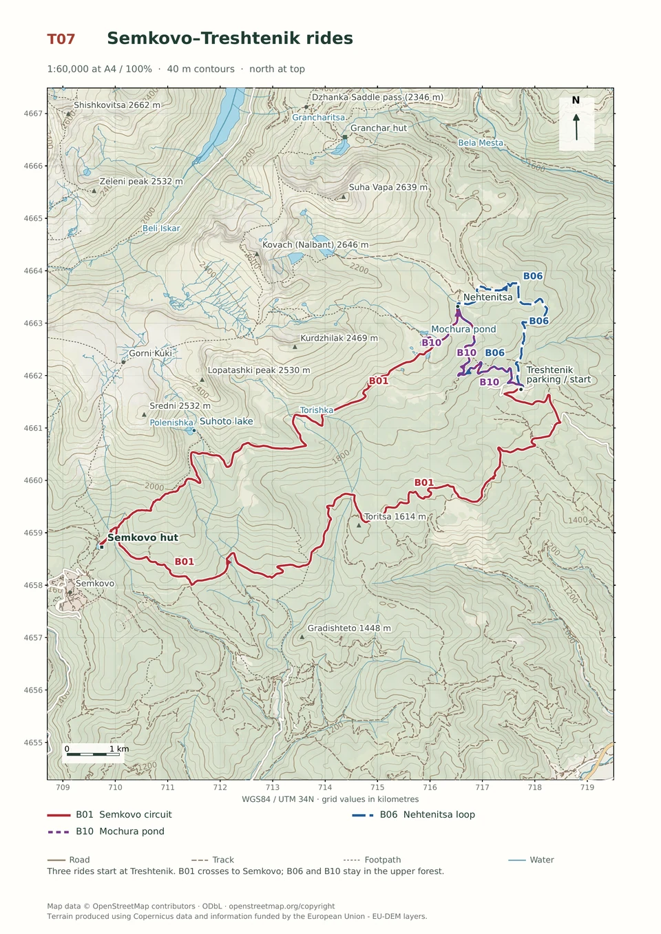
Treshtenik–Mochura Pond
1–2 hours
10.9 km · ↑ 330 m · Return ride
From Treshtenik parking · transport to the start
Leisure riders comfortable climbing on asphalt and ordinary gravel.
View route and mapClimb by road to Nehtenitsa, then return through the forest on a rocky descent with roots and steeper turns.
Regular cyclists confident braking on a rocky forest descent. Arrange transfers to and from Treshtenik parking.
Follow the line marked B06. Loop.

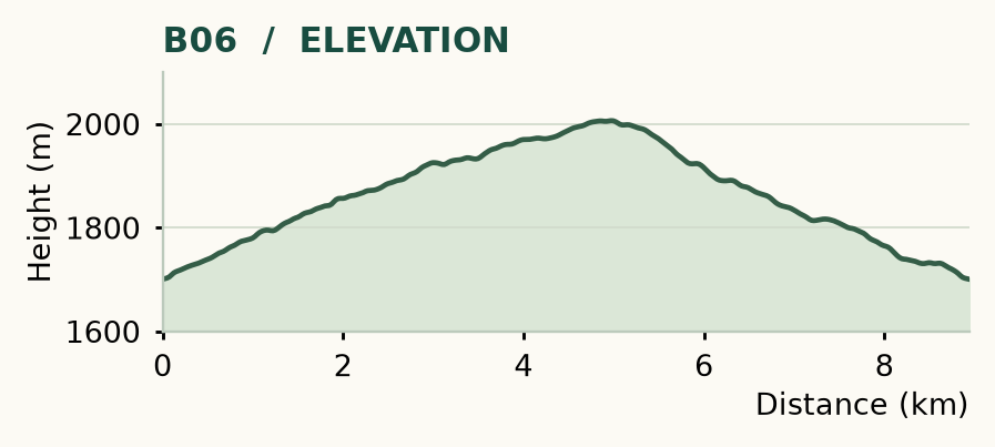
Distance and ascent above follow the mapped route using terrain-model heights. Elevation: 1700–2006 m.
8.9 km · 310 m ascent · 1–2 hours · moderate technical demand, R1/R2 · low effort, KFN4. Start and finish at Treshtenik parking.
Mapped profile: 8.94 km, 320 m terrain-model ascent. Original guide estimate: 8.9 km, 310 m ascent. These are separately published figures; the profile uses terrain-model heights.
Complete ride · 8.9 km. Rounded labels on the original map or profile may differ slightly. The original guide estimates are retained here for comparison; use the full figures for your chosen starting point.
Who it’s for: Medium. Regular cyclists confident braking on a rocky forest descent.
Short enough for half a day, rough enough to hold your attention: this loop climbs by road and comes back through the forest. Roots, stones and steeper descending turns make it a step up from Mochura.
Ride: turn right uphill at 0.4 km, stay on asphalt at 2.3 km, then turn right at Nehtenitsa, 4.1 km, towards Granchar. At 4.8 km, take the meadow track right. Keep right by the shepherd huts and follow the rocky forest descent, staying on the main track at 6.2 and 6.8 km. Cross the Banenska stream area, continue straight at 8.3 km, then pass through the bungalow roads to the asphalt and your starting point.
Refill at Nehtenitsa if the fountain is flowing. Fallen trees and the stream crossing can interrupt the descent. Keep to the open main route through the bungalow area and obey park signs on the upper section.
Easy · B10
1–2 hours
10.9 km · ↑ 330 m · Return ride
From Treshtenik parking · transport to the start
Leisure riders comfortable climbing on asphalt and ordinary gravel.
View route and mapExpert · B02
1–2 hours
6.3 km · ↑ 380 m · Loop
From Yakoruda mineral pool parking · transport to the start
Riders confident on steep, loose descents and exposed turns.
View route and mapExpert · B14
1–2 hours
7.7 km · ↑ 380 m · Loop
From Yakoruda central square · transport to the start
Riders confident descending the steep Vodolaza hillside tracks.
View route and map