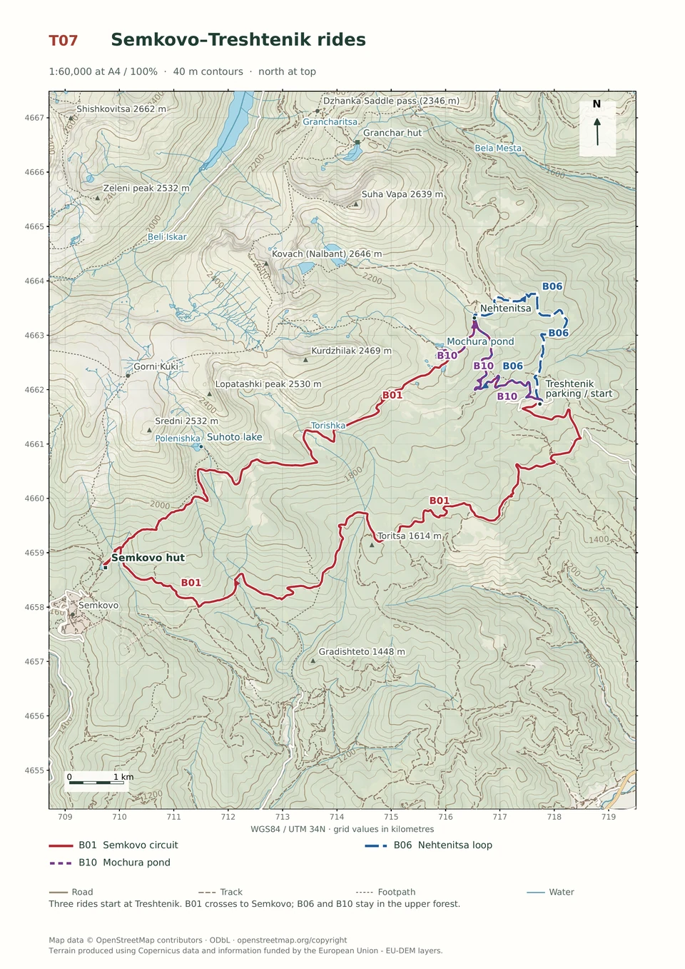
Easy · B10
Treshtenik–Mochura Pond
1–2 hours
10.9 km · ↑ 330 m · Return ride
From Treshtenik parking · transport to the start
Leisure riders comfortable climbing on asphalt and ordinary gravel.
View route and mapClimb east from Yakoruda into the Western Rhodopes, then descend technical tracks and a long stairway back into town.
Riders confident descending the steep Vodolaza hillside tracks. Arrange transfers to and from Yakoruda’s central square.
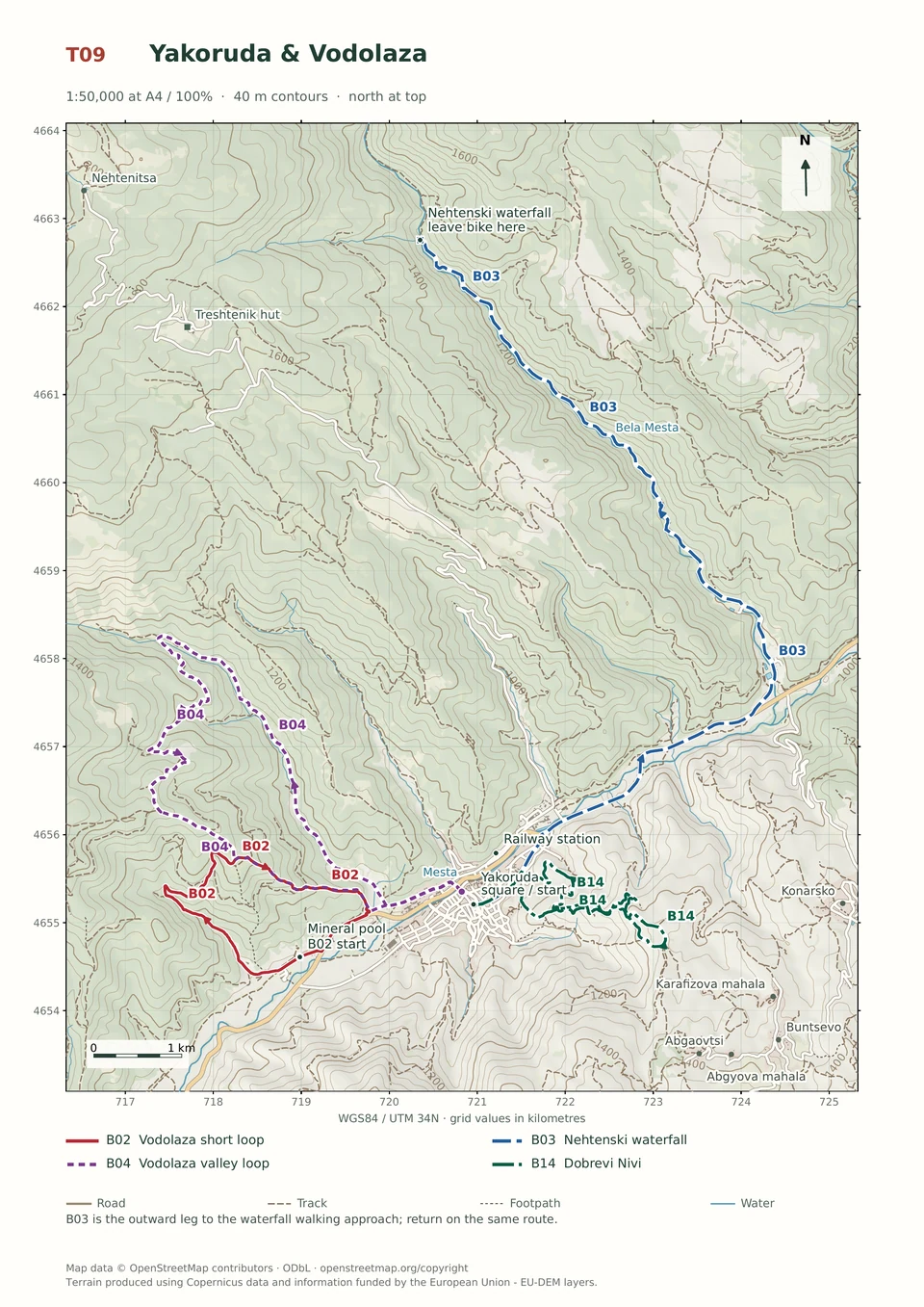
Follow the line marked B14. Loop.

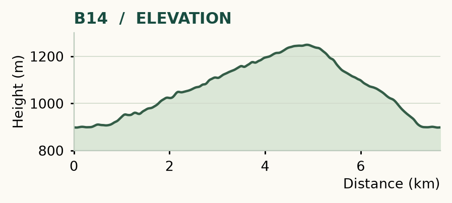
Distance and ascent above follow the mapped route using terrain-model heights. Elevation: 897–1249 m.
7.7 km · 345 m ascent · 1–2 hours · advanced, R1/R2/T3/T4 · medium effort, KFN5. Start and finish at Yakoruda's central square.
Mapped profile: 7.67 km, 380 m terrain-model ascent. Original guide estimate: 7.7 km, 345 m ascent. These are separately published figures; the profile uses terrain-model heights.
Complete ride · 7.7 km. Rounded labels on the original map or profile may differ slightly. The original guide estimates are retained here for comparison; use the full figures for your chosen starting point.
Who it’s for: Expert. Riders confident descending the steep Vodolaza hillside tracks.
Here the ride moves east into the Western Rhodopes and finishes with a long stairway back into town. Dobrevi Nivi is not Dobarsko: it is a different place, a different landscape and a short technical outing in its own right.
Ride: head northeast along Tsar Boris III, turn right uphill at 0.7 km and follow the main dirt climb. At 4.9 km, take the faint left-hand line across the meadow. Go right into the forest near 5.1 km, then left after about 100 m. Follow the trail sections across successive roads, cross again near 6.6 km and keep right at the branches. A meadow crossing near 7 km leads towards the town stairs and the square.
Expect technical obstacles and possible overgrowth. Yield at road crossings and walk the stairs when pedestrians are present. There are no dependable fountains on the ride; carry water. The sandy, open sections are more pleasant in cooler hours.
Easy · B10
1–2 hours
10.9 km · ↑ 330 m · Return ride
From Treshtenik parking · transport to the start
Leisure riders comfortable climbing on asphalt and ordinary gravel.
View route and mapMedium · B06
1–2 hours
8.9 km · ↑ 320 m · Loop
From Treshtenik parking · transport to the start
Regular cyclists confident braking on a rocky forest descent.
View route and mapExpert · B02
1–2 hours
6.3 km · ↑ 380 m · Loop
From Yakoruda mineral pool parking · transport to the start
Riders confident on steep, loose descents and exposed turns.
View route and map