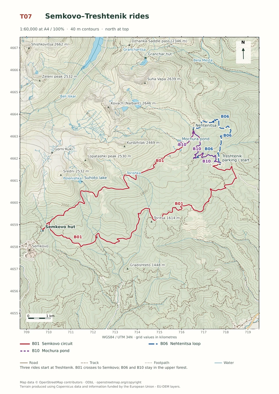
Expert · B01
Treshtenik–Semkovo, Below Suhoto Lake
3–6 hours
32.4 km · ↑ 970 m · Loop
From Treshtenik parking · transport to the start
Expert riders on T4 singletrack; expect steep rock and possible carrying.
View route and mapA long paved climb to Treshtenik leads into a remote forest-road descent through mountain hamlets and the Grashkina Mogila area.
Fit regular riders ready for a long climb and remote forest-road descent. Arrange transfers to and from Yakoruda; the market parking is occupied on Saturdays.
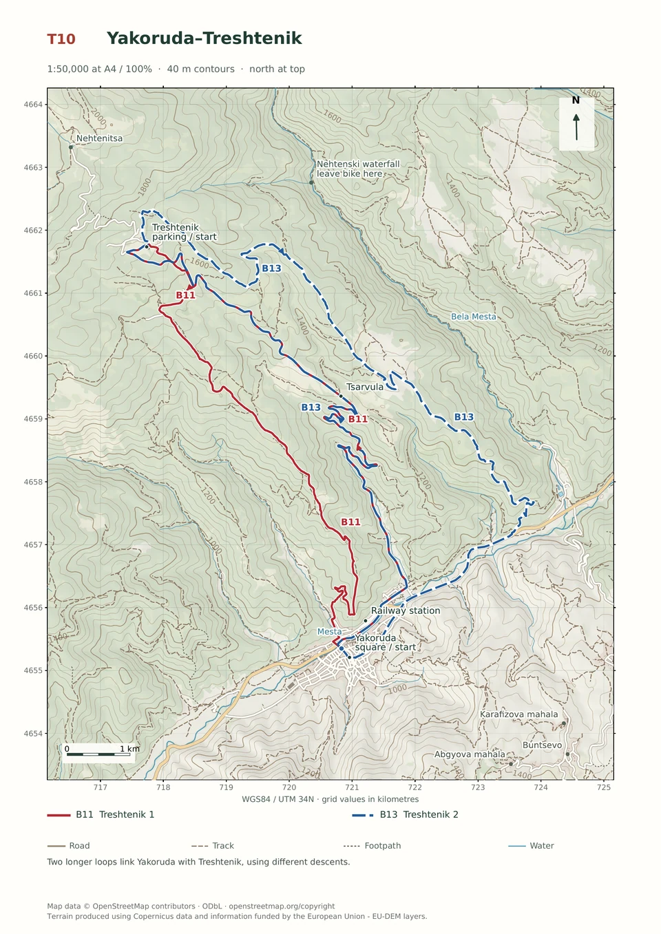
Follow the line marked B13. Loop.

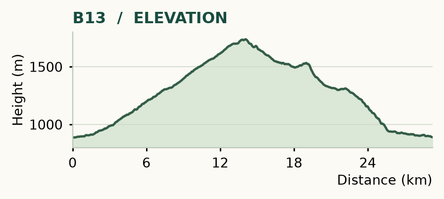
Distance and ascent above follow the mapped route using terrain-model heights. Elevation: 887–1738 m.
29.3 km · 885 m ascent · 3–6 hours · moderate technical demand, R1/R2 · medium effort, KFN6. Start and finish at Yakoruda market parking.
Mapped profile: 29.28 km, 980 m terrain-model ascent. Original guide estimate: 29.3 km, 885 m ascent. These are separately published figures; the profile uses terrain-model heights.
Complete ride · 29.3 km. Rounded labels on the original map or profile may differ slightly. The original guide estimates are retained here for comparison; use the full figures for your chosen starting point.
Who it’s for: Experienced. Fit regular riders ready for a long climb and remote forest-road descent.
The paved climb is long, the hamlets are a welcome change of scene and the descent gives you plenty to do. This is the more predictable Treshtenik loop, but it still belongs to riders comfortable on rough forestry roads.
Ride: cross the Mesta bridge, turn right on the main road, then left after roughly 800 m at the Treshtenik sign and cross the railway at the barrier. Follow the paved climb. At 13.1 km, turn right towards Treshtenik Hut. From the parking, climb briefly, then leave right for the bungalows at 13.6 km. Descend right at 14.1 km and take the left fork at 14.7 km, passing Kausha and Kyorovi Kolibi. Turn sharply left in Yurcheni Kolibi at 16.2 km, then left again after 300 m. At 17.9 km, continue straight/right towards Grashkina Mogila.
Below the summit, walk the steepest 200 m if necessary. At 20.2 km, join the broader road. At 20.6 km, leave it straight as it hairpins right. Ignore left spurs at 21.5 and 21.7 km, take the left fork at 22.6 km and the right at 23.1 km. At 24.8 km, turn sharply right onto the rougher logging road down towards the Mesta valley. Reach the Yundola–Yakoruda road only by a lawful railway crossing, then turn right for town and the market.
Refill on the climb: there are no fountains on the descent. Watch for logging traffic, loose ground and confusing new branches. The roughly 14 km / 800 m paved ascent alone makes this a substantial day, even before the descent begins.
Expert · B01
3–6 hours
32.4 km · ↑ 970 m · Loop
From Treshtenik parking · transport to the start
Expert riders on T4 singletrack; expect steep rock and possible carrying.
View route and mapExperienced · B11
3–5 hours
24.0 km · ↑ 920 m · Loop
From Yakoruda market parking · transport to the start
Fit riders confident on steep, rutted mountain-road descents.
View route and mapExpert · B05
3–5 hours
26.8 km · ↑ 960 m · Loop
From Yakoruda market parking · transport to the start
Fit riders with reliable handling on long, rough mountain tracks.
View route and map