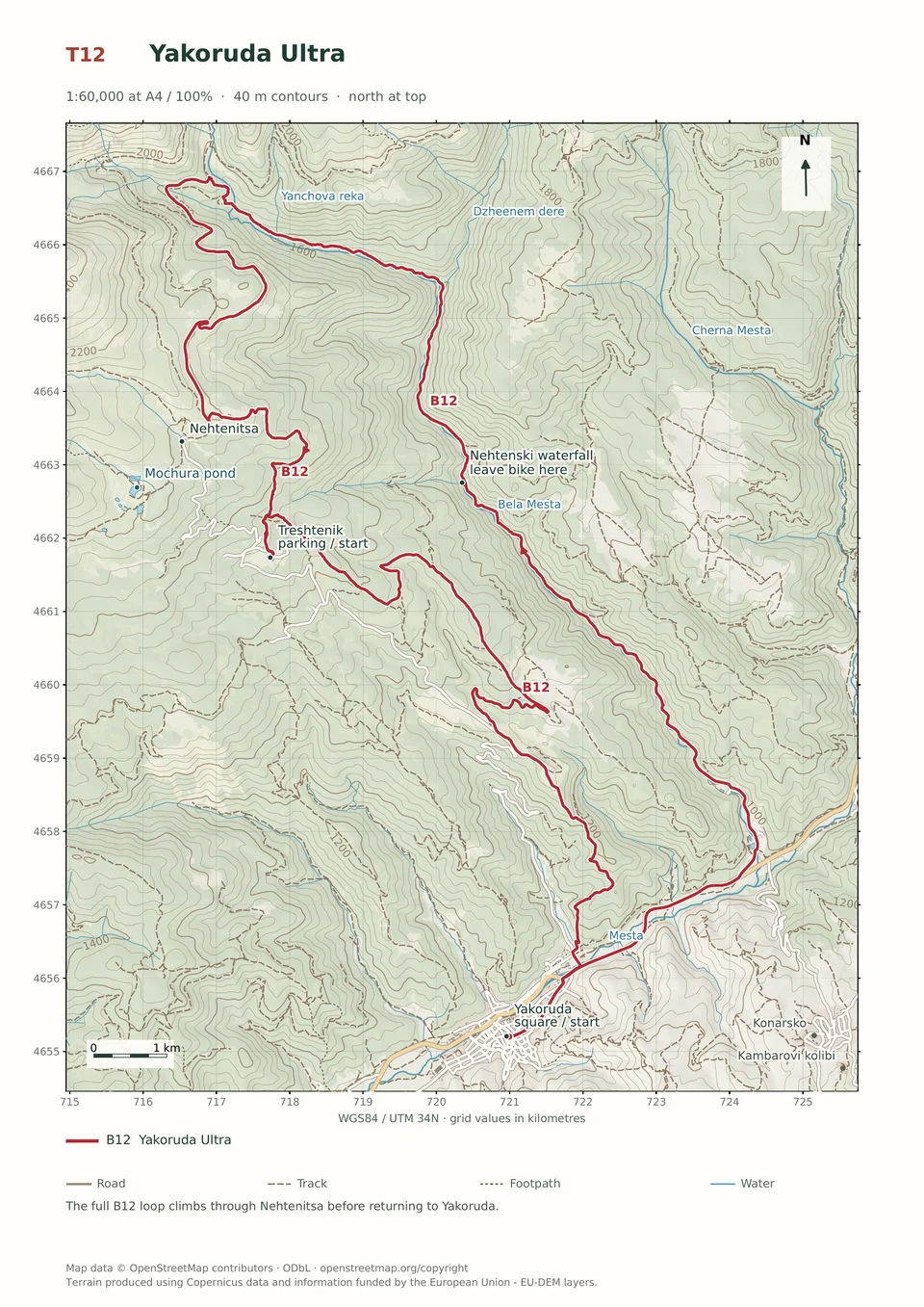
Expert · B12
Yakoruda Ultra
5–10 hours
44.5 km · ↑ 1540 m · Loop
From Yakoruda central square · transport to the start
Expert groups prepared for carrying, blocked tracks and severe erosion.
View route and mapAn all-day circuit joins the high contour below Suhoto, Semkovo Hut and Vodolaza, with two hard singletrack sections.
Expert riders with all-day stamina, T4 skills and carrying capacity. Arrange transfers to and from Yakoruda; Saturday market parking is unavailable. A Semkovo Hut start adds the agreed Coliving connection to the totals.
Follow the line marked B08. Loop.

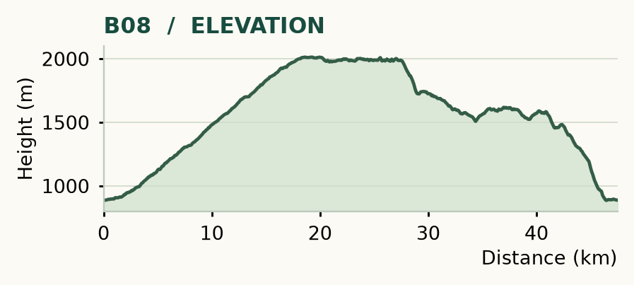
Distance and ascent above follow the mapped route using terrain-model heights. Elevation: 885–2013 m.
47.5 km · 1,360 m ascent · 5–10 hours · advanced, R1/R2/T4 · high effort, KFN8. Start and finish at Yakoruda market parking.
Mapped profile: 47.51 km, 1,680 m terrain-model ascent. Original guide estimate: 47.5 km, 1,360 m ascent. These are separately published figures; the profile uses terrain-model heights.
Complete ride · 47.5 km. Rounded labels on the original map or profile may differ slightly. The original guide estimates are retained here for comparison; use the full figures for your chosen starting point.
Who it’s for: Expert. Expert riders with all-day stamina, T4 skills and carrying capacity.
The big one combines the high contour below Suhoto with the Vodolaza descent. Two hard singletrack sections, rough roads and sustained climbing fill a proper mountain day. The broad time range is a reason to start early, not to plan on the fastest end.
Ride: climb from Yakoruda to Treshtenik at 13.4 km, then Nehtenitsa at 17.5 km. Visit the Mochura spur and take the waterworks contour west. Road becomes trail around 26.4 km; join the yellow/green descent at 27.5 km and continue to Semkovo Hut. Head east, take the sharp left at 32.3 km and climb. Turn right at 37.4 km, then head south by Toritsa around 38 km. Keep to the main forest roads, turn left at 42.2 km, and enter Vodolaza at 44.4 km. Cross the road near 45.4 km and return to town using the designated railway crossing beyond 46.3 km.
Arrange park access in advance: the high singletrack below Suhoto crosses national-park terrain, where a marked walking path does not automatically permit bicycles. Agree the exact route, date and group with the Directorate before riding. June–September is the usual window, subject to snow and weather. Refill around Semkovo Hut and carry a full day's food. Avoid old event side-trails between Toritsa and Vodolaza; use the main-road line. Saturday market parking is unavailable.
Expert · B12
5–10 hours
44.5 km · ↑ 1540 m · Loop
From Yakoruda central square · transport to the start
Expert groups prepared for carrying, blocked tracks and severe erosion.
View route and mapExpert · B01
3–6 hours
32.4 km · ↑ 970 m · Loop
From Treshtenik parking · transport to the start
Expert riders on T4 singletrack; expect steep rock and possible carrying.
View route and mapExperienced · B13
3–6 hours
29.3 km · ↑ 980 m · Loop
From Yakoruda market parking · transport to the start
Fit regular riders ready for a long climb and remote forest-road descent.
View route and map