Semkovo on the map
Find the resort, choose a trail or plan a day in the valley. Select a category to bring its places into view.
Detailed print maps Choose a category to explore the map and its place list.
Browse places and routes
Detailed maps to enlarge or print
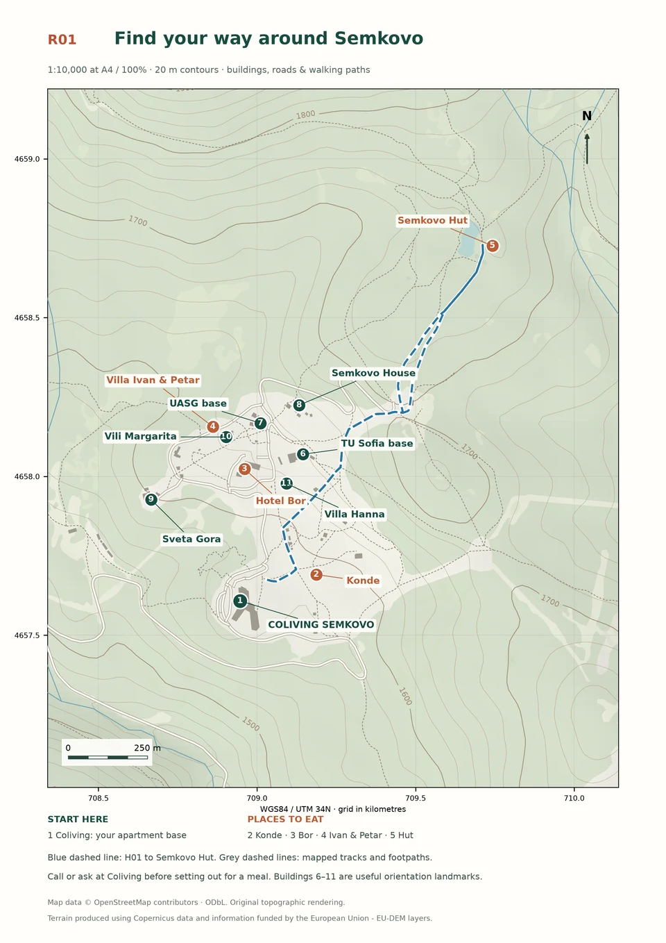 R01 / Find your way around Semkovo · Coliving, places to eat and the main resort landmarks. The blue dashed line follows H01 to Semkovo Hut. View full mapMap data © OpenStreetMap contributors, Open Database Licence; terrain produced using Copernicus data and information funded by the European Union, EU-DEM layers
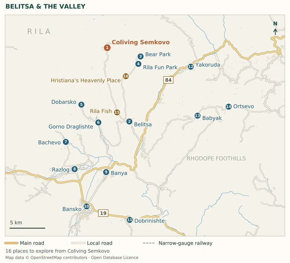 Belitsa and the valley · The valley below Semkovo: Belitsa, village outings, thermal pools and the road towards Bansko. View full mapMap data © OpenStreetMap contributors, Open Database Licence
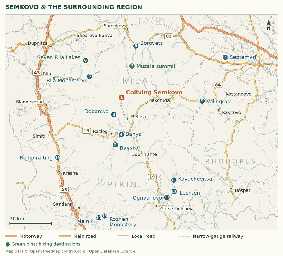 Regional days out · A wider circle of day trips: the Rila and Pirin mountains, the Rhodope villages and the Struma valley. View full mapMap data © OpenStreetMap contributors, Open Database Licence
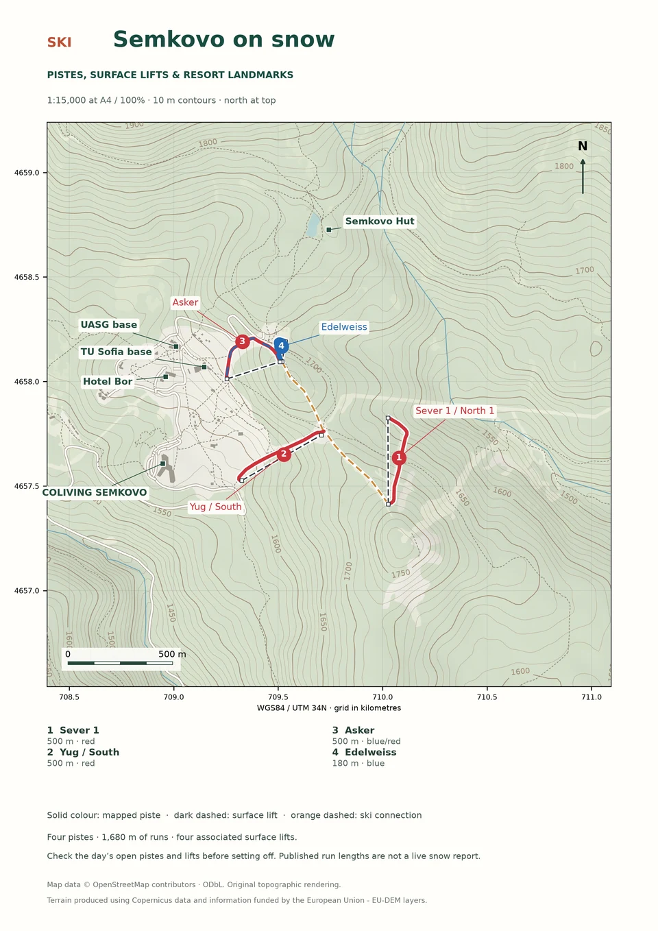 map-ski / Semkovo on snow · Sever 1, Yug, Asker and Edelweiss, with their associated lifts and retained connections. View full mapMap data © OpenStreetMap contributors, Open Database Licence; terrain produced using Copernicus data and information funded by the European Union, EU-DEM layers



